green space maps
Green space maps originate from efforts to distinguish public and private space, such as the influential map of Rome by Giambattista Nolli. In the USA, this evolved into maps that show parks and other green spaces that the public could access in towns and cities, including Olmstead’s map of Boston’s Emerald Necklace and Chevalier’s tourist map of San Francisco.
La topografia di Roma di Gio (1773)

City of Vergennes, Town of Middlebury (1876)
Plan of portion of Park System from Common to Franklin Park (1894)

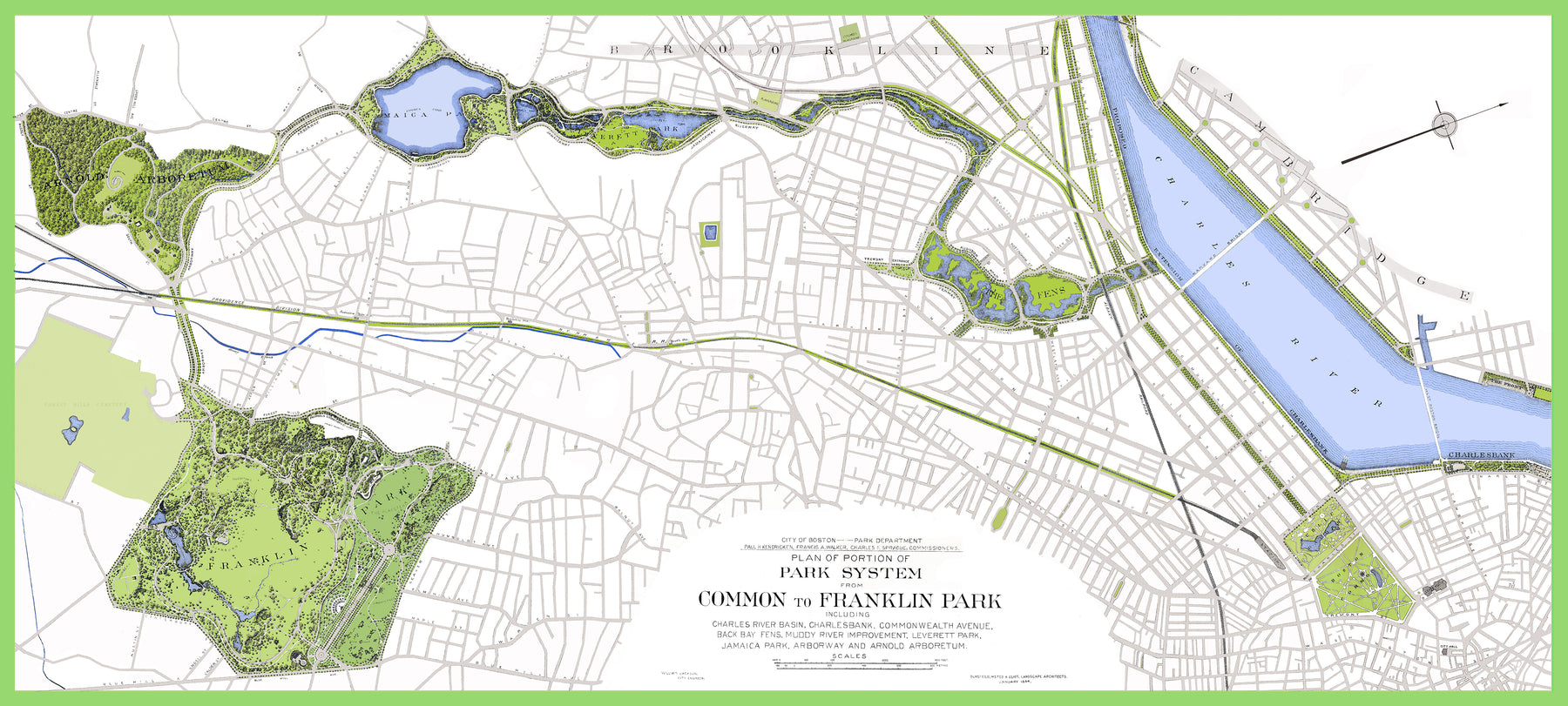
Olmstead map colorized by Elena Saporta