the three Ts
Writing geospatial workflows brings together three domains:
-
Thematic: the vocabulary, concepts, principles, theories, etc. of your application domain; the academic discipline, professional context, etc that defines the terms and beliefs of your inquiry.
-
Technical: the concepts and methods of the geographic information software that you are using to develop your workflows. For example, Google Earth Engine Javascript API, ArcGIS Pro, QGIS, GDAL, etc.
-
Theoretical: the timeless concepts and methods of geospatial analysis and cartography; the body of knowledge that you need to understand to solve geospatial problems regardless of the thematic or technical domains that you are working in.
more soon
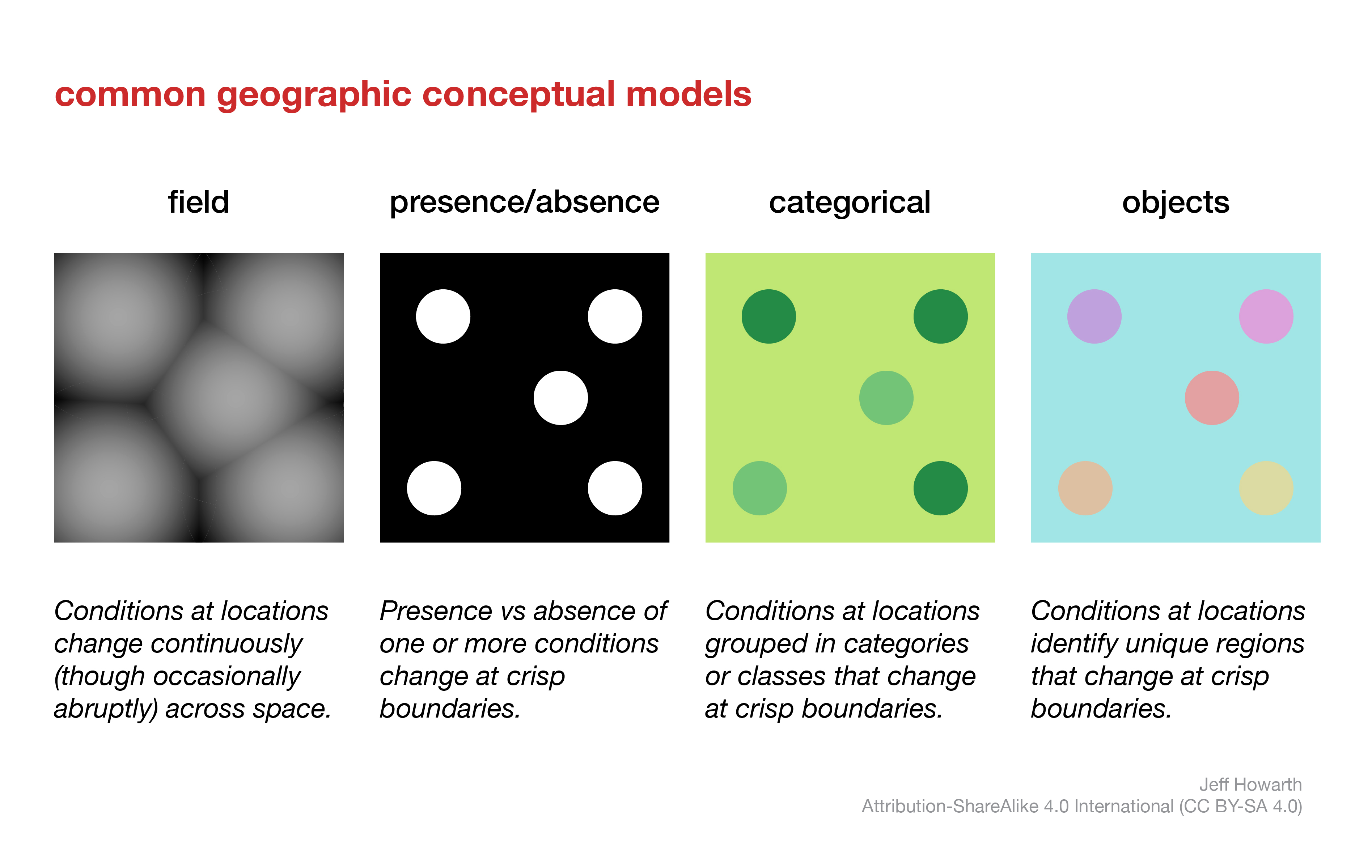
conceptual models
A key idea in geospatial workflows is that you can represent the world as a series of map layers for computation and comparison. So it is helpful to become familiar with the relatively small set of conceptual models that geospatial workflows tend to employ as instruments for representing the world as map layers.
data models
When you develop geospatial workflows, your recurring task is to move between conceptual models and data models. In other words, you conceptualize a way to represent geography and then you implement this concept with a data model.
more soon
This work is licensed under CC BY-NC-SA 4.0![]()
![]()
![]()
![]()