Landsat lexicon
There are a number of different Landsat collections in the Earth Engine Data Catalog. To be able navigate the collection, you should be comfortable with the following key terms.
Missions
The Landsat program consists of a series of missions. Each mission deploys one or more sensors on a satellite. Very practically, the mission’s name denotes the launch sequence. Landsat 1 launched July 23, 1972. Landsat 9 launched September 27, 2021.
Sensors
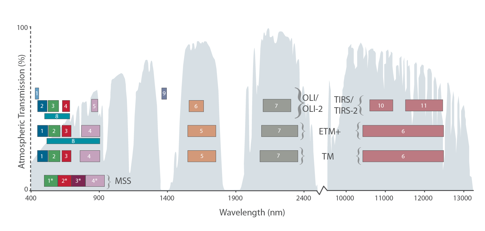
The sensors onboard the Landsat satellites have steadily aimed to improve upon Norwood’s original MSS.
- MSS: Multispectral Scanner
- TM: Thematic Mapper
- ETM+: Enhanced Thematic Mapper
- OLI/OLI-2: Operational Land Imager
- TIRS/TIRS-2: Thermal Infrared Sensor

Collections
There have been two major reprocessing efforts by USGS to improve data quality. Collection 2 is the most recent and has the best geolocation accuracy which improves time series analyses.
Tiers
Within a collection, Tier 1 data have the highest radiometric and positional quality. USGS recommends using Tier 1 data for all future time-series analysis.
Levels
Distinguishes the level of data processing applied to products.
-
Level-1 includes processing to improve locational accuracy of data.
-
Level-2 products are built from Level 1, but also provide atmospheric correction to create surface reflectance and surface temperature products. Level-2 science products also include spectral indices derived from surface reflectance products.
-
Level-3 products are built from Level-2 products and include Analysis Ready Data (ARD), including Fractional Snow Covered Area and Burned Area, and Scene-based Inputs, including Provisional Actual Evapotranspiration.
What do the sensors measure?
Here are two key terms:
-
Radiance is the amount of energy measured by a sensor, typically reported in units of watt per pixel area.
-
Reflectance is the proportion (ratio) of the amount of energy reflected from the surface versus the total amount of energy striking the surface.
What/of where do the sensors measure?
Here are three common terms:
-
Raw scenes: DN (digital number) values represent scaled, calibrated at-sensor radiance.
-
Top of atmosphere (TOA): calibrated top-of-atmosphere reflectance.
-
Surface reflectance: atmospherically corrected surface reflectance and land surface temperature.